

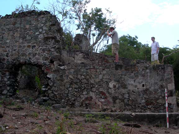
Thanks to a grant from the Virgin Islands Humanities Council, the Friends, and the professors and students from the University of Maine, we are spending the next few weeks mapping plantation ruins into 3-Dimensional space on the computer. We archeology interns have spent our last week helping to get the Maine students situated and ready to work as they left the cold and snow and arrived down here in the fun and sun. We spent a few days getting their tents ready at Cinnamon and a field tent at Leinster Bay to protect the equipment. The students are now hard at virtual preservation.
The Maine students are using an additional program that is proving to make modeling much easier and more efficient to use with the other programs. The new program allows them to photograph the ruins from a variety of angles and, using dots they have placed around the ruins, “sew” these photographs together. We are already seeing exciting results after only three days of work. The students already have one wall complete and are working on modeling a well and another wall. We presented the work to members of the press and supporters this morning at the ruins and have another presentation on Monday.


1 comment:
Good luck to all students from the University of Maine at Cinnamon Bay. I have visited Cinnamon Bay four times since 1986 (starting with Halley's Comet and most recently last month), and I'm thrilled to learn that you're working to document the amazing natural and cultural resources there. I look forward to reading every word of this blog. (I am about to move to Topsham and work at Bates ...)
BTW, feel free to use any of my Creative-Commons-licensed images at Flickr in your work:
- 2006
- 2003
Post a Comment