Thursday, February 23, 2006

Cave Expedition II


Exciting weeks-- We find the Prehistoric Caves, Evidence from the 1733 Slave Revolt, and an Underwater Cannon that may Predate the Danes dating to the 1600s. Graphing C-14 dates give New Insights into the Pre-Columbian Peoples at Trunk Bay.

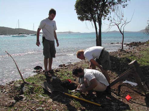
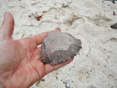
This week we are analyzing and cataloging the artifacts we unearthed in our Caneel Bay shovel tests. It is painstaking work but is necessary to complete our research and ensure that the artifacts are easily accessible to future archeologists who might continue after our efforts. Our first step in this process is cleaning the artifacts, which was done with the help of two volunteers. We then analyze the artifacts from each unit and level separately. We weigh and count everything we find. In some cases, we might discard some objects, such as shells that are not related to the archeological record and therefore not diagnostic. We still have to ID them, record their weight, and count each species. Everything we keep we sort by the thousands of diagnostic attributes they may fall into, and then assign each sorted object(s) a catalog number. Lots of prehistoric pottery was recovered and interesting stone tools (one of which is pictured in a previous blog entry). There are also several stone grinders and numerous stone flakes that indicate tool creation. During our analysis, we discovered one artifact that was particularly unique and which we incorrectly thought was a stone flake at the dig site. Upon closer examination, Ken determined it was actually a French gunflint probably for an eighteenth century musket. It is possible that this artifact along with the early colonial pottery is evidence of the French troops who were brought to St. John to quell the slave revolt of 1733.

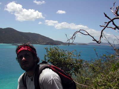
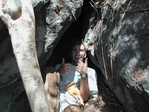
Connor and I also had to return this week to examine the caves we found for evidence of prehistoric occupation and to explore for more caves. This time we remembered to bring a headlight. This helped a great deal, as we were able to actually see inside the caves. In the first cave, Connor found one small potsherd on the surface. It was exciting to discover that these caves were used by Tainos or perhaps their ancestors. At the next rock overhang, we found several more potsherds and charcoal. We also found two more small caves, one of which had a Cittarium pica shell, locally known as whelk, which was a prehistoric food source, but could have also been the former home of a Soldier Crab. I hope that future investigations will reveal good diagnostic artifacts and give us deeper knowledge into the extent of occupation and the caves' use.


A couple of weeks ago Ken and Susanna followed up on a lead that park biologist Thomas Kelley discovered while diving in the park. Thomas reported spotting what looked like a small cannon. Upon inspection it appears that, indeed, it is a cannon but of the most unusual design. It may be possible that the cannon is from the 17th century as the design and pottery in the area appear to go back to a pre-Danish era. More information will be forthcoming about the cannon as investigations continue.

Over these last two weeks, we have also had the pleasure to host Dr. Emily Lundberg and her husband Bert and his daughter Deborah. Dr. Lundberg came from Montana to work with Ken on the Trunk Bay ceramics. We interns just recently completed entering some several thousand ceramic data records into an Access program so they could start asking the data some questions. While we were out in the field, Bert and Deborah addressed the lab’s visitors allowing Emily and Ken a chance to focus on the work. Their goal is to define the ceramic chronology of the Virgin Islands from AD 800 to 1200. The dates for the site became much clearer this week after Ken graphed out the fifteen C-14 dates. He found that excavations conducted for the ramp that begins at the fee booth, the septic tank next to the concession area, and the present men’s bathroom all clustered within a 200-year period beginning in AD 1000 and ending around AD 1200. Two other sectors of the site were found to date to AD 800-1000.
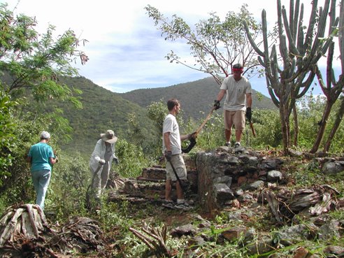
Friday, February 17, 2006

Sierra Club, Elderhostel and Historical Society


Monday February 6-Wednesday February 15
Clearing vegetation from historic ruins has kept us busy these last couple of weeks but we have had plenty of volunteer help from the Sierra Club and the Elderhostel. These groups have generously provided their vacation time in St. John to help us keep Colonial era ruins free of destructive vegetation. This work helps to preserve the ruins and makes them visible for the public but is especially important this week because of two upcoming projects.

The first sets of ruins were Yawzi Point and Little Lameshur Bay. The park has received funds to restore some of these ruins. Therefore, a first priority is to clear the vegetation to allow the historic preservationists access to the ruins to assess them and begin work. The Sierra Club made it possible to clear all these historic structures in three days. Next, we cleared the ruins at Leinster Bay. In this undertaking, we enlisted the help of an Elderhostel group and a new group of Sierra Club volunteers. It was important that this work be done now to prepare for a group of engineering students and their teachers from the University of Maine.

As part of a Virgin Islands Humanity grant, U. of Maine is coming back in March to continue the park’s efforts to model endangered ruins in 3D. We had to clear enough brush away from the structures to allow them to be photographed from a distance, as well as to be accurately measured. Since there are at least 500 ruins on St. John, it is impossible to restore or preserve all of them now. The hope is that they can be preserved on computers in 3-dimensional space. Not only will this allow interested parties to tour the ruins in cyberspace, but it will also create an exact blueprint of the structures so that they could, hypothetically, be rebuilt in the future. It is, for now, our one financially viable way to preserve this past for our children before they become piles of unidentifiable rubble.

We also assisted the St. John Historical Society and Elderhostel in clearing the Annaberg School ruins. The goal here was to make the ruins a more picturesque and enjoyable place to visit. We were more than happy to help on their effort to help the park.

We owe a big thank you to the Sierra Club and Elderhostel for all of their hard work. Without them we would spend many more days getting these ruins cleared of the destructive vegetation. We appreciate them taking time out of their vacation to help us.

Cinnamon Bay: Proposed Museum Exhibits in 3-D

BY Ian Kaminiski-Coughlin

My internship has a different objective from those of the other interns. Ken Wild contacted one of my professors at the University of Minnesota in search of someone with knowledge of historic architecture to design museum exhibits and new laboratory fixtures for the Cinnamon Bay Archaeology Lab. Michael Milne, known to St. John as the barefoot architect, has taken me into his office of five (one of the largest firms on St. John) and donated my wages to the Friends of the Park to accomplish this. I work on this project half the time and help with Michael’s busy residential practice the other half.
The building in which the museum and new lab will be located in one of the oldest structures still in use (1680’s) on island and, as such, is a fitting locale. Presently there is no venue to display to the public the park’s diverse collection of prehistoric, maritime, and colonial artifacts. I feel fortunate to be one of the first contributors to this project that will display this island’s heritage to the local community and their visitors.

Wednesday, February 08, 2006

Shovel Tests in Paradise


For the past two weeks Mick Wigal and myself (Andrew Connor) have been conducting shovel tests at Turtle Point in Caneel Bay. Our hope is that this example of mitigative archeology will help us gain a better understanding of the layout of the pre-Taino village and any historical structures that existed in the area, while exploring for areas of the site that have been disturbed. We know a prehistoric site exists in the area due to the abundance of potsherds on the surface and artifacts that have been found there in the past.

Our first few days at the site were spent working with the laser transit. The transit allows us to create a survey map of the shoreline, trees, parking lot, shovel test units, and any other features on the site. Once we've "shot" these features into the transit we can transfer the data to a program on the computer that will allow us to create a map of the site.

After grappling with the transit for several days we created a grid on the site that would allow us to easily locate our shovel test units. Ken chose to dig four .5 X .5 meter units. These units were spread across the grid. They allowed us to determine the extent of damage due to machinery, examine artifacts in an area threatened by erosion, and explore a squared mound of soil.

It took us two weeks to complete all four shovel tests but we found some interesting artifacts. All four holes contained numerous prehistoric potsherds and ecofacts consisting of cittarium pica shells (a large snail), conch shells, parrotfish vertebrae and beaks, and other small snail shells. These are examples of food remains and the conch could also be used as a tool.

One unit was filled with stone flakes that are created by scraping pieces off a stone core. This suggests that there may have been a prehistoric stone tool factory in this area. We only found one example of historic pottery. Our most exciting find came on January 1. While excavating I came across a stone axe or scraper that had obviously been chipped down to a very sharp edge.

Thursday, February 02, 2006

A Farewell to James


Intern James Trombetti left today to return home to Kentucky. Although James was a biology major, he took a great interest in archeology. He was a hard worker and excellent asset to the team. As an intern James worked on Cinnamon Bay shoreline, Trunk Bay, and Turtle Point excavations, while also assisting in mapping, historic structure preservation, and interpretation. He will be missed by everyone. James is planning on attending Ranger School in the fall to become a law enforcement Park Ranger. Good luck James!

Wednesday, February 01, 2006

In Search of Prehistoric Caves

January 16, 2006-January 20, 2006

This was an eventful and exciting week for the archeology interns. The new intern, Andrew Connor, arrived on Monday from Massachusetts. I'm sure the weather change was more than welcome. His first day was spent getting familiarized with the Cinnamon Bay lab and getting to know everyone.

James Trombetti and I gave our first St. John archeology talk to tourists at the lab. Andrew listened to get a taste of some of the island's Taino and plantation history. The talk was a success, with eighteen people attending. Everyone gave us good reviews and several people came back later to thank us.

The most exciting event of the week, though, came on Wednesday. Ever since I started working, I have heard of a purported prehistoric cave on the North Shore. Apparently two archeologists surveyed St. John in the 1950s and briefly wrote about the cave in their subsequent report. Rumors about the cave abound around the island. Lots of people have heard of it and seemingly everyone knows someone who knows where it is. Frustratingly, no one has told us where it is.

James and I have already hiked up the point twice looking for it but to no avail. We actually have a method for looking for it. Using the GIS program on the computer, we look at an aerial photograph of St. John and find points on Mary's Point that look like they would have terrain suited for a cave. We then enter these points into the GPS. The GPS aims us in the direction of the points and shows us where we've been so we don't survey the same area multiple times.

For our third trip, we headed for a huge rock that sticks out above the trees. The jungle was thick with thorns but we eventually made it to the rock. The entire area was covered with huge boulders. The first one we examined had a narrow hole that was just big enough for a person to crawl through. The hole opened into a small room that was big enough for maybe two people to stand in. I crawled in but didn't see any artifacts or petroglyphs. There was a layer of soil in the bottom of the cave so we may have to excavate in search of a human presence. We found several other rocky overhangs that could possibly be considered caves. We only explored about half of the boulders, so more exploration will be necessary to determine if other caves exist.