Thursday, February 15, 2007

Traces of the Past


(1780 Oxholm Map, partial, with Jochumsdahl)


Happy Belated Valentine’s Day, everyone! Here in Love City the holiday certainly did not pass unnoticed—restaurants were flooded, street corner stands were selling packages with teddy bears and chocolates, and the color red could be seen everywhere. Now business is back to usual, and the cultural resources team is using the morning hours to update you all on our latest projects.
The most exciting discovery we made last week was locating the “lost” plantation, Jochumsdahl. An ever-useful map of St. John created by Oxholm in 1780-1800 indicates that a plantation existed north of the Catherineburg Plantation. Because there has been such little rain recently and hence minimal underbrush, last week was an ideal time to explore the area in hopes of locating Jochumsdahl. So Ken, Susanna, and I headed into the woods with the GPS, the camera, and sticks in hand to swipe away spider webs. We first found what looked like an old trash site from the early 20th century. Old pulleys, hand carts, and other UID rusty metal objects were strewn about in a stand of bamboo as well as a plethora of gin bottles. Ken dug into the earth a bit with his trowel and found a layer of charcoal just beneath the surface, indicating that this site was used to produce charcoal after emancipation. Workers would clear an area of foliage and hollow out a depression to burn it in, producing charcoal. Because the fire problably needed to be monitored, the workers must have relaxed with a drink of gin while the fire burned down. This charcoal production site is not related to Jochumsdahl, but it is very interesting nevertheless because it tells of another period in St. John history—slightly more recent but no less important. Photographs were taken of the trash and the charcoal, and a GPS point was taken so that the National Park can return to this site later for further research. (evidence of charcoal making)


After identifying the charcoal site, Ken, Susanna, and I spread out to cover more ground and soon enough we discovered a brick that Ken believes is related to Jochumsdahl. He postulates that it is a remnant of the enslaved village located south of the plantation because the debris scatter we saw is indicative of the ephemeral wattle-and-daub huts. A few more bricks were found as well as a black lead-glazed course earthenware fragment. This pottery fragment is dated to 1700-1770 and is the one diagnostic artifact we found for Jochumsdahl. So, at the end of the day we re-discovered a portion of the site of the “lost” plantation. Most likely, the actual building materials of the main plantation structures were scavenged for use in later plantations, which means we won’t find intact ruins forgotten in the woods. But archaeological excavations can undoubtedly provide more information on the history of the elusive Jochumsdahl. (the last remaining traces of Jochumsdahl)


Also last week, the cultural resources team enjoyed a historic lecture at the site of Rustenberg given by Chuck Pishko. Elderhostel volunteers worked on completing architectural drawings of certain structures of the site and Chuck came to explain the purpose of each structure in the sugar-making process. He also told us about the history of the plantation, which includes a visit from the Crowned Prince of Denmark in the early 19th century. (Chuck Pishko and Elderhostel at Rustenberg)


The last bit of news I have to offer is that the excavation at Cinnamon Bay of the plantation cookhouse floor is complete. The area was cleaned, photographed, and reburied. Digging will commence soon at a different location so that we can re-intern the human remains found at Cinnamon. Well, this has been a long post and I hope you made it through. The cultural resources team at Virgin Islands National Park will keep on chugging and we hope that you’ll keep reading. Thanks, guys! Until next time.

Tuesday, February 06, 2007

Ecofact

As usual, the cultural resource team has been very busy. This morning, Ken and Susanna went to VIERS to welcome a group of Sierra Club members. This group has adopted the Yawzi Point Ruins and Lameshur Ruins and we are so thankful for their work to keep the ruins clear of vegetation. While on the south shore of St. John, the team also investigated an archaic(4oo b.c.) site with many ecofacts, or ecological remains such as conch, and whelk(citeriumPica) shell that would have been a food source for these early St. John inhabitants. In addition, there were shell edged pearlware fragments that my indicate a maroon site, or a place where escaped, captured Africans may have gone into hiding. It was a very interesting day, and aside from collecting data from the archaic site, the new gps was put into use. The terrain remains dry and hopefully, we will find time to do more exploring of little known sites such as Ramshead, pictured here, while the vegetation is a little less dense.

Yesterday, the team met with an Elderhostel group at Cinnamon which is adopting the Leinster Guardhouse ruins and also doing architectural drawings of the Rustenberg Ruins. Ken gave the group a brief talk about the history of the island and then they went on their way to cut vegetation. Like the Sierra Club, we are very thankful to have such dedicated volunteers. After the talk, Ken and Susanna pulled the two bottlenecks out of the Cinnamon Bay Kitchen site and put the final touches on the map and used the very big ladder to take some site photographs. They are waiting Amber's help later in the week to cover the site back up.
(Cinnamon Bay Excavation, Final Photo)
We are a couple weeks behind because Amber was off a week while her parents were visiting and the internet service has been inconsistent. During the previous weeks, Susanna did a lot of curating and Ken met with the Danish Professor, Niklas Thode Jensen from Copenhagen. Niklas and his students will be researching the Danish archives for us for the next few months, then the students will be making the journey to St. John to obtain first hand knowledge of the plantations, specifically, Lameshur. We are very excited to be working with Niklas and these students and eagerly await their arrival in May.
Niklas and Ken looking at Fort Willoby on Hassel Island

Thursday, January 18, 2007


Hello, everyone! I hope the new year has been treating you well. The Cultural Resources Team at Virgin Islands National Park has accomplished some very interesting things since the last blog. First, Ken and Susanna are now Rescue Diver certified (re-certified in Ken’s case). I opened up the Cinnamon Bay lab during their training and talked with the beach-goers while cataloguing artifacts. The following day (last Friday), Ken and I visited the Lameshur site with Sean Krigger, an architectural historian from the Virgin Islands State Historic Preservation Office, and RandyBrown, Director of the Virgin Islands Environmental Research Station (VIERS). Randy would like to restore some of the historic Lameshur plantation buildings for use as classrooms and exhibit space. The restoration as well as the regular maintenance needed when the buildings are in use will undoubtedly help to preserve them for future generations. However, the restoration must be done with historic accuracy in mind so that the buildings are preserved looking as close to what they originally looked like as possible. This requires buying period-accurate hinges for windows and doors as well as having the windows and doors be constructed in a suitable style and painted with a special paint in an appropriate color (see the painting of Lameshur dated to about 1840’s in the blog archive (May)). I learned that lime mortar and silicate paint are the preferred materials for repairing and painting historic walls because they are water permeable. Therefore, when historic bricks soak up ground water, the water will not be trapped within the wall and disintegrate the bricks but will diffuse through the mortar and paint and eventually evaporate. Sean advised Randy on the modifications that are and aren’t allowed and what types of restorations are preferred. Next, plans will be drawn up and work can ideally start within the year. Ken offered to help as much as he could when the actual construction started, he used to be a brick layer.
This Tuesday, I came in and the Team mapped a large portion of the excavation site at Cinnamon Bay. Susanna cleaned the kitchen surface and measured object dimensions (rocks, mortar, brick, shell, glass, and metal) and I drew the map on graph paper (see picture above). I gave a tour in the afternoon, but it wasn’t the best ever. I hope that with practice I’ll get more familiar with the subject material and be more comfortable speaking to an audience about it. A snorkel survey of the beach in the late afternoon recovered many remains and artifacts likely uncovered by the recent Northern swells (we’ll have to investigate it further after the mapping is finished). The old tree we often used as a reference point finally fell over with this last swell. Well, until next time everyone and feel free to post comments and/or questions. We love to hear from our readers!

Monday, January 08, 2007

Rave Reviews


Happy Belated Holidays, everyone! It is the year 2007 now and St. John is busy. Your friendly neighborhood Cultural Resources Management Team (a.k.a. Ken, Susanna, and I) is back in action. I have been furiously preparing to start giving tours at Cinnamon Bay, which I’m both excited and nervous for. I have reviewed the pre-Columbian and colonial history of the Cinnamon Bay site by re-reading the articles that are posted on the Friends website (if anyone is interested in details, look no further). The single, lonesome man on my inaugural tour today gave me rave reviews, haha.
The excavations of the kitchen floor ar3e complete at Cinnamon Bay plantation house and the site has been cleaned off in preparation for mapping, which we began today. Ken is teaching me a slightly older technique of mapping involving a level drawing board and compass in which the site is mapped in-field. Once the map is finished, the site will be back-filled and we will choose a different place to re-intern the enslaved human remains.
In the office, Ken has just completed a part of a paper dealing with the early history of the United States Virgin Islands—Tainos, pirates, including Captain Kidd, European refugees, enslaved Africans, and all. The other contributing author is a Syracuse University Ph.D canidate and she is focusing on the 1733 Slave Revolt along with the conflict that arise from multiple cultures coming into contact within the Caribbean . The two pottery fragments pictured, along with the unusual bone tool, date to 1650 to 1670 the period privateers and pirates flourished here. Once the paper is finalized, we'll make it available and you can learn more!

Wednesday, January 03, 2007

Zemis and Coins


Rudy and Irene, the owners of R & I Patton Jewerly, are two people to whom the interns owe a great deal of thanks. This is because R & I Patton donates to the Friends archeology program 100% of the sales of gold and silver zemis sold in their store. They also provide bronze and silver zemis to the Friends to sell in our boutique or on the web at http://www.friendsvinp.org/store/patton.htm

Irene Patton, under the guidance of Ken Wild, archeologist with the National Park Service Caribbean Archeology program, made replicas of ceramic artifacts (zemis) found at the Trunk Bay and Cinnamon Bay sites. The terra cotta zemis were made by the Taino Indians who lived on St. John before Columbus. They represented spirits of ancestors, animals, birds and reptiles that served to convey special messages to the present and other world. They were attached to bowl rims and were broken after ceremonial use.


Rudy and Irene are also invaluable for their knowledge of coins and have provided some information regarding the 1822 Curacao coin featured in the previous blog. Rudy reports that"

"The coin is from (no surprise) Curacao Netherlands Antilles. The minting date is not so certain (surprise!)
This coin is a 1 Stuiver which is on the reverse side with a star in thelower field. The obverse has Curacao in the upper field, the date, 1822 inthe middle field and a star in the lower field below a line. The coin wasminted in the Netherlands (as Denmark minted coinage for use in the DanishWest Indies) in 1822 and then the dies were used again when it was alsostruck in 1840-1841. So even though it carries the date 1822, it may havebeen minted in 1840-41. It circulated at that later date as a 2 Centpiece. The star was the mint privy mark for the either the Enkhuizen mintor the Hoorn mint in West Friesland, The Netherlands.
This was shortly after the second British occupation of Curacao during theNapoleonic Wars (1800-1803 and 1807-1816.)
--1994 Standard Catalog of World Coins, 21st Edition by Chester L. Krauseand Clifford Mishler (covering coinage 1801 to 1994) Newer editions areavailable from Amazon.
BTW it is probably worth less than $100 on the World Coin market. Thecondition would be "Fine." This is the lowest condition assigned. Of course it is invaluable as a part of the excavation in Cinnamon Bay."
Ed Rothfuss adds that "It took 48 of these little silver coins to equal 8 reaals (schellings) or one peso, the equivalent of our 19th century silver dollar."
Many thanks to R&I Patton for providing this information and for their great jewerly! Please visit their website at http://www.pattongold.com/ to learn more.


Friday, December 15, 2006

Then and Now

A month or so ago Ken, our archeologist, spoke at a St. Thomas Historical Society meeting and met Jane Sheen who was interested in helping the park in its efforts to gather historic documentation on park resources. A few weeks ago, Ken and Susanna took a trip over to St. Thomas to meet Jane Sheen, and look at her collection of historic postcards of the Virgin Islands. The postcards date from the late 1800 hundreds to the early 1900 hundreds and many of the images captured park resources still in use, like the photograph above with the Reef Bay Factory still in operation. Others capture the people and the times like learning to make baskets at the turn of the century. The postcards are great and Jane was so helpful. That day she loaned 100 + cards right then in order for us to scan the images. This week, Susanna spent a few hours scanning in the images, front and back, because the back of the card can indicate when it was published. Eventually, we hope to process all the images and make them available online. Below one of the cards, shows the Creque Marine Slipway in full operation.


This is an image of the structure as it stands today. Thank you Jane for making this wonderful contribution.


Monday, December 11, 2006

5oth Cultural Posters

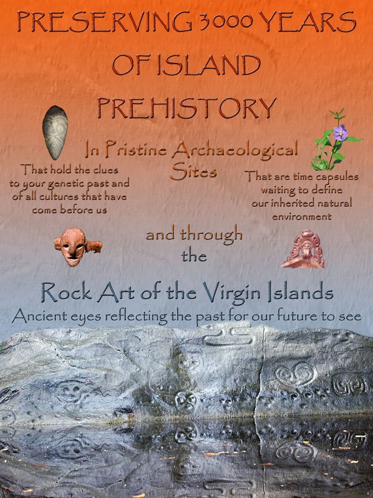
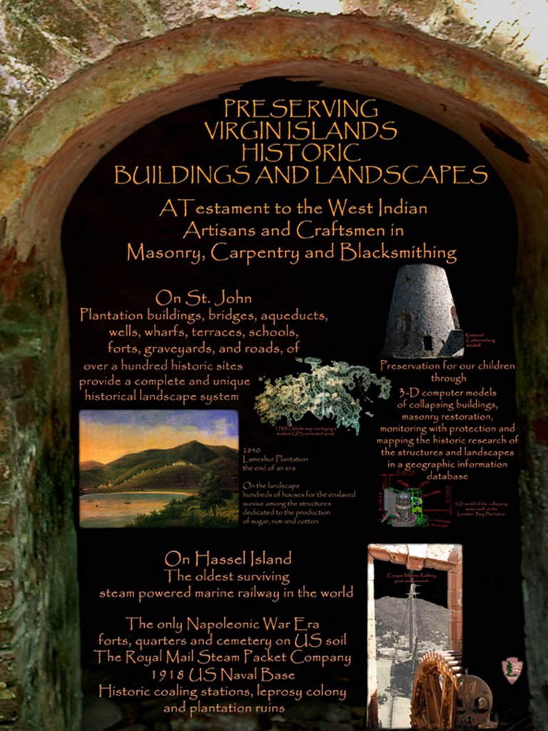
Here are the 50th cultural resource posters I mentioned in our last posting. We now have them on display at the Cinnamon Bay Archeology Lab.


undefined

Friday, December 08, 2006

VINP 50th Anniversary

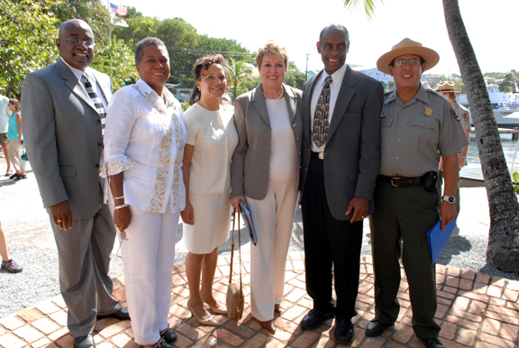
Hi, this is Amber, the one and only archaeology intern (for the time being) at the VI National Park. Long time, no see readers! Our blog site had to go through government security approval before we could get back to you. We have been busy these past few weeks, and I mean really busy. The 50th anniversary of the creation of the Virgin Islands National Park was celebrated last Friday, December 1st. Speakers, who included Virgin Islands Delegate to Congress Donna Christensen, Southeast Regional Director Patricia Hooks, and Director of the National Park Service Mary A. Bomar, discussed how successful the park has been since its inception in protecting both the underwater and land resources of this Caribbean paradise.(all pictured below)


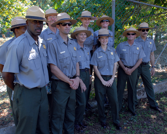
They also emphasized the importance of the continuation of this work into the 21st century. Modern dancers from the St. John School of the Arts performed as well as local quadrille dancers, and the Steel Pan Dragons played some Christmas songs to get everyone into the holiday spirit. (NPS Staff in CLASS A Uniforms)
I sat at an exhibition table during the ceremony with four posters that archeologist Ken Wild created for the occasion. The posters, which are shown below, detail the different aspects of cultural resources preservation in the Virgin Islands National Park—maritime, prehistoric, historic architecture, and the collections that connect to the communities past. I talked with people who were interested in the current archaeological projects and hopefully with funding all can proceed as planned. A great buffet and a 50th anniversary cake finished the celebration and I must say it was great to see both park officials and the community gather together for this event. (NPS Employees:first row Devon Tyson, Dave Sapio, Christy McManus, Tina Bernier, Ken Wild, Thomas Kelley, second row: Esther Francis, Rafe Boulon, Susanna Pershern, Carrie Stengle)
This week, with the 50th anniversary celebrations behind us, we have gotten back to what we do best—digging in the dirt! Eight members from the Las Vegas Sierra Club volunteered to continue excavations of the cookhouse located near the Great House of the Cinnamon Bay plantation. Joe and Ellen Ries, Bill and Billie James, Marge and Ed Rothfuss, Barbara Gerhart, and Linda Nations planned a week-long service trip to St. John and were delighted when they found out they would be working with Ken Wild on a dig. The historic floor of the cookhouse was originally discovered because local clergymen and Ken Wild had chosen the area for reburial of the human remains washing up at Cinnamon Beach. The remains are thought to be of African descent. The Sierra Club volunteers helped to expose the entire cookhouse floor, which was dated from the 1820’s to the 1840’s by the type of pottery and glass recovered, and Ken and Susanna will photograph and document it next week. Marge found a coin minted in 1822 in Curacao (shown below) which may shed some light on trade relations at Cinnamon Bay. After proper documentation is complete, the floor will be reburied and a new site will be chosen for the burial of the human remains. Also below is a photograph of the team working at the excavation site. Well, that’s all for now, everyone. Until next week:)


Friday, November 03, 2006

Nice Work!


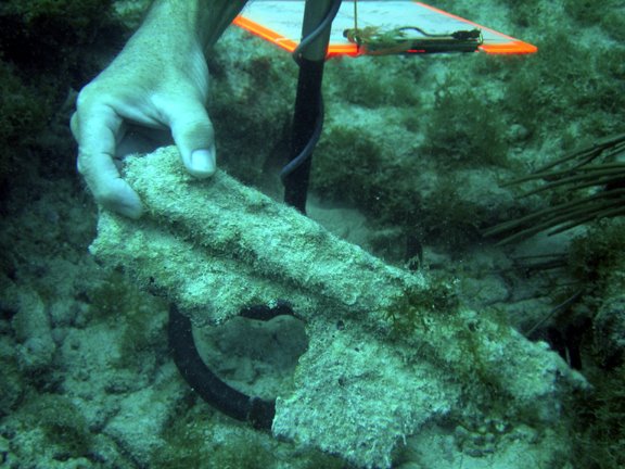
Hello everyone! Amber is back after a week hiatus from the blog. Things have been busy on St. John, both in the office and out in the field. Last week, I served as surface support for Susanna and Ken while they dived to a depth of 73 feet to investigate historic metal objects. Preliminary conclusions are that it is marine-related, but more underwater time will be needed to further identify the objects. Surface support is important for dangerous dives such as these, the danger being both the dive depth and a site location in the middle of a busy channel. Also last week, Ken prepared for a presentation about Hassel Island to the St. Thomas Historic Trust. I wrote earlier about this island’s historical importance and funding is sorely needed to begin the processes of survey, stabilization of the ruins and conservation of the wonderful metal artifacts.

This week has also been productive. In the office, a monumental cataloguing project has been undertaken by yours truly, and it definitely feels good to get all our artifacts organized and documented correctly. Ken also went over the talk with me that he prepared this week for the Science in the Park Conference. This was kind of a first for Ken to prepare a paper for biologists(see his title slide with a Indian and Jellyfish above). He said it made him look at the island’s archaeological record differently, not just from an anthropologist’s view point. He explained to me how the 3000 years of history in the archeological sites also preserves, for the biologist, time capsules waiting to define our inherited natural environment.


In the field, the team (Ken, Susanna, and I) completed a snorkel survey and found some interesting artifacts. In a historic context, Susanna found a worked mammal bone in a concretion of coral and rock…definitely worthy of placement in the future museum. (And a nice thing to find before she heads off to the Grand Canyon for two weeks of NPS Fundamentals Training.)
Aside from archaeological project advancements, I have officially become comfortable driving on the left [pat on the back]. It’s really not as hard as I thought/ feared! OK, well this is all she wrote for now. I’ll write next week with the latest from the Cultural Resources Management Division here at St. John. ‘Til then:)

Friday, October 20, 2006

Gearing up


Blog 10-20-06
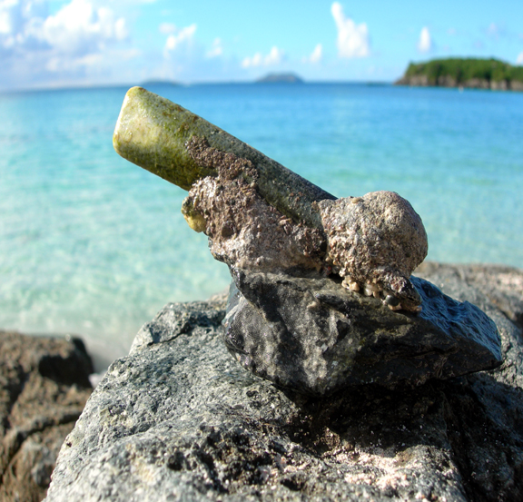
The doors to the Cinnamon Bay Archaeological Lab were thrown open for the first time this season. Ken, Susanna, and I have started to unpack the exhibits to get the lab ready for visitors, and two of the historic bottles found last week have been cleaned for display. One has been identified as a Gordon’s gin bottle (with a funky hog’s head design on the front), but we’ll have to do some homework to ascertain its age. It can’t be older than 1918 because of its color, which tells us it is not associated with the shipwreck.
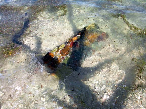
Today, we journeyed out to Hassel Island with two rangers to familiarize them with the island’s extensive cultural resources (so that they can protect them). Almost from the beginning of European expansion into the New World Hassel Island has been associated with the early Spanish, pirates and English privateers. The island becomes even more important as commerce expands and serves as the midway stopover for ships traveling from Europe, New England, to South America and the Pacific, making it very significant in the realm of maritime history. The oldest marine railway—Creque Marine Railway—is located on Hassel, as well as the only Napoleonic fortifications on American soil. The long-term plans for the island are to preserve the historic structures, in concert with archaeological and historical oversight. I think the public would love to see and learn about this fascinating island. Pictured above are two partially submerged anchors at the north shore of the island.

Friday, October 13, 2006

New Intern!


Hello everyone! My name is Amber Davis and I am the VINP Cultural Resource Team’s newest intern. I moved down here from New Hampshire and just recently received a B.A. in Chemistry from Bowdoin College with a minor in Anthropology. Naturally, I am interested in archaeochemistry, or chemistry as it is applied to archaeology, and it sounds like I will be able to help with a lot of projects here. From soil testing to the identification of pottery residues, I only hope that our efforts here can contribute additional knowledge about the pre-Columbian residents of St. John. Speaking of, I have been reading a lot about the Taino—the Caribbean natives who greeted Columbus—and what I have read has been fascinating. Did you know that bats symbolized their dead ancestors’ spirits and that the English words “hammock,” “canoe,” “tobacco,” and “barbecue” originate from the Taino language? Sweet.
In the past two weeks (of which I am here only on Thursdays and Fridays), the team has been exploring a new shipwreck (the anchor is pictured in a previous blog). Historic bottles from ~1850’s were found and a few metal objects were detected, but not excavated. These objects are teasers, however, because we still have yet to determine why the ship wrecked. Many projects are planned for this year and I look forward to sharing the results with you as the work progresses down here on St. John. Until next week:)

Unidentified Metal Artifact among Shipwreck Scatter

Friday, October 06, 2006

Maho Bay


It is late Friday, and we still have much to do, including the Museum Annual Checklist and rearranging in the Bally Building to create a space for a new map cabinet, however, we wanted to post the press release about the recent developments regarding Maho Bay. In short, the Virgin Islands National Park will eventually recieve a large track of land thanks to the Trust for Public Lands (TPL) hard work towards preserving this large track of land for the public. One aspect of our mission is to know what is in the park, and before any land transfer this has to be determined. Ken is already thinking about the survey methods and documenation that will have to happen to to help TPL and NPS to properly manage and protect the cultural resources on the land. On Monday, Ken and Susanna rode out to Maho to take a quick look at the new aquisition, including a unique and perplexing ruin, that Susanna nicknamed the "bus stop" due to it's proximity to the road. Please read the press release for more informaiton.

St. John, U.S. Virgin Islands, 9/5/2006 - The Trust for Public Land (TPL), a national nonprofit land conservation organization, today announced it has signed a contract to buy and preserve a 415-acre property in the heart of St. John that ultimately will become part of Virgin Islands National Park. It would be the biggest preservation project on St. John since the National Park was created in 1956.

The property, known as Estate Maho Bay, will be added to the park when federal funds become available, said Greg Chelius, director of TPL's program in Florida and the Caribbean.

"The national park on St. John is one of the world's great treasures," said Chelius. "We are very excited to be part of the effort to preserve its incredible natural beauty."

"TPL has been working on preserving Maho Bay for more than five years and while there have been a lot of challenges, it looks like we're finally on the road," Chelius continued. "We have a lot of hurdles to go, and we have to raise millions of dollars to make this happen, but we're confident that Estate Maho Bay will be protected."

The property has more than a quarter-mile of beachfront on pristine Maho Bay and rises to almost 1,000 feet in height. It also has significant ruins from the Danish colonial era, 1700-1860 and may have pre-Columbian cultural resources from the Taino Indian people, who inhabited St. John for 800 years before Christopher Columbus arrived. Just offshore are seagrass beds, green turtles and coral reef systems which are visited by thousands of people every year.

"Protection of this large property by TPL represents a very significant event for the V.I. National Park and for St. John. Development of this watershed would have had considerable impact on the natural and cultural resources of the park as well as residents and visitors to St. John," said Rafe Boulon, native St. Johnian and chief of resource management, V.I. National Park.

TPL has been working for years to acquire the property, which was owned by 11 heirs of Harvey Monroe Marsh. In fact, John Garrison, director of TPL's Southwest Florida Office and lead project manager on this acquisition, was interested in preserving this property before coming to TPL five years ago, when he was director of Friends of the Virgin Islands National Park, a nonprofit on St. John dedicated to protecting the park.

Garrison said that the property has not been subdivided, so that each heir owns 1/11 interest in the entire parcel. Six heirs agreed to sell their interests to TPL. TPL had previously purchased one interest. The NPS owns three interests and the 11th is being retained by one of the heirs. By contract, the purchase price of the six interests is to remain confidential. The heirs are also each retaining a six-acre lot, with the ability to build up to two homes.

"Preservation of this property will be the culmination of many, many years of work," said Garrison. "A lot of credit goes to the heirs, who were willing to work with us and gave us a significant bargain on the sale, as well as to the Friends group for their continued support." A spokesperson for the Marsh family said, "Maho Bay has been in the family for over 100 years so it is important to the family to retain ancestral home sites and at the same time preserve the natural beauty of the estate for future generations to enjoy."

"The preservation of Estate Maho Bay, one of the most popular and cherished areas within VI National Park, is a significant accomplishment that will benefit the people of St. John and all those who will be able to visit and enjoy this magnificent area," said Joe Kessler, president of Friends of Virgin Islands National Park. "The Friends and all those who love VI National Park will be forever grateful to TPL for their persistence and imagination in making this a reality, to the donor for their generosity in financing the acquisition and to the heirs for their foresight and commitment to preserving Estate Maho Bay. We are pleased to have been a part of making this happen."

The Trust for Public Land (TPL) is a national nonprofit land conservation organization that conserves land for people to enjoy as parks, gardens, and natural areas, ensuring livable communities for generations to come. Since its founding in 1972, TPL has helped protect more than 2 million acres of land in 45 states. Working in Florida since 1975, TPL has protected more than 300 sites - over 200,000 acres at a market value of more than $500 million. The Trust for Public Land depends on the support and generosity of individuals, foundations, and businesses to achieve our land for people mission. For more information please contact us at (850) 222-7911 or visit us on the web at www.tpl.org/florida.

Monday, October 02, 2006

Archives

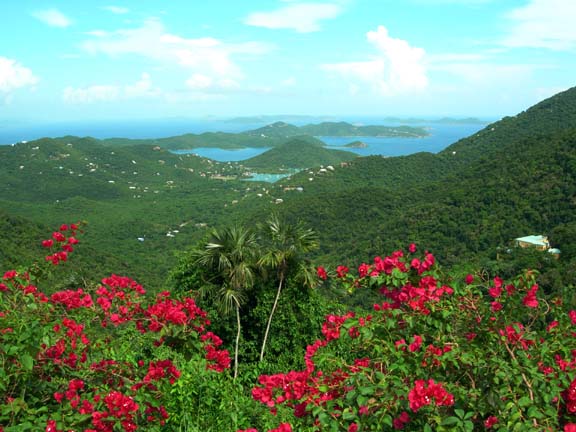
Bordeaux Mountain Overlook

Last week, Ken and Susanna had the pleasure of working with Ryan Polk, an Archivist from the Atlanta Regional Office. Ryan spent the entire week surveying and identifying the archives of the Virgin Islands National Park. It was a huge job as federal employees must maintian and save any documents related to their work at the park. Seeing as though the VINP is celebrating their 50th Anniversary this year, there is a half century of records filed away in offices, storage facilities, trailers and buildings. In addition, the tropical climate wreaks havoc on the old paper documents and sometimes it seemed as though Ryan's job could have been featured on Mike Rowe's "Dirtiest Jobs." Fortunatly, Ryan was able to have a short tour of the park along the Northshore and then back to town via Centerline Road, where we stopped and took a photograph of the famed Bordeaux Mountain Overlook.


Ryan Polk, Regional Archivist

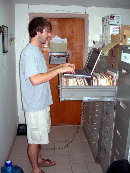
Ryan and Susanna met with many individuals from the different divisions within the park. Here's Ryan working on the files at maintenance, which contain many maps and park plans, project reports, equipment data and all the documents that keep the Roads and Trails, Buildings, Signs, Water, Waste, Carpentry, Boat Mechanics and Vehicles running.

Ryan returned to Atlanta with all the information and will put together an Archive Plan for the park. Then it will be time to decide which files stay permanently with the park, which go to NARA (National Archives and Records Administration) and which files can be shredded. In addition to surveying all the archives, Susanna had the opportunity to see what was in other divisions.

(Genti Bay Ruins Eroding)
Finally, on Friday afternoon, Ken, Susanna and Ryan went out on the boat to collect some photographic documentation of the Genti Bay Ruins for ASMIS (Archeological Sites Management Information System) It was a great chance for Ryan to see the real thing - Reef Bay, Genti, Lameshure, Coral Reef Monument - all of which were mentioned in the archives. Along with finding intact ruins, they also found that some of the Genti Bay Ruins were eroding from the beach. In addition, evidence of a prehistoric settlement was documented. All in all, a very productive week.

Monday, September 18, 2006

Summer


Cinnamon Bay Beach and the Archeology Lab

The archeology program is slowly awakening from it's summer slumber, although there's hardly a soul on the beach. There are no interns as yet, as it is too hot too stay in the tents and the threat of hurricanes keep Cinnamon Bay campgrounds closed for this month. Nevertheless, Ken and Susanna have been seen doing archeological monitoring of road crews digging holes for traffic counters. However, they do enjoyed staying cool at the Biosphere in the air-conditioned office working on the collections, getting ready for the regional archivist or performing underwater archeological investigations of a historic anchors for our Archeological Sites Management Information System (ASMIS)


Submerged Historic Anchor


Earlier this week, while finally completing the annual inventory, Susanna spotted the 1707 Danish silver Kroner coin and an almost new silver 10 kroner coin dating to 1714, both in the Cinnamon Bay Historic collection. These coins were instumental in helping the park determine the archeological record and the story of the people who lived at Cinnamon Bay before the Islands were offically colonized by the Danes in 1718. The archeological record of this shoreline indicates that the area was occupied decades before official Danish colonization in 1718. This is a fascinating period of St. John history involving Amerindians, Africans, Settlers and Pirates! More information about the Settlement at Cinnamon Bay may be found at the Friends of the Park Website.

Authentic Danish Kroner