Tuesday, May 02, 2006

Inventory

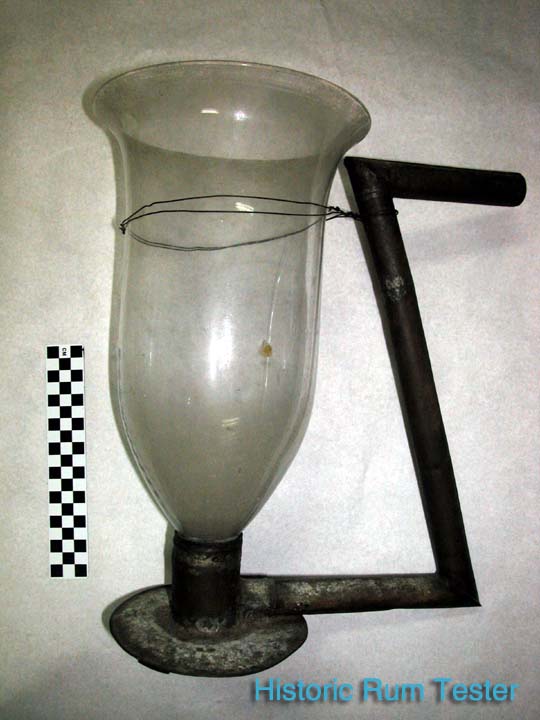
Rum tester used for Rum Production at Reef Bay Plantation, catalogued in 1960.

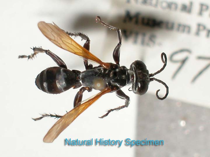
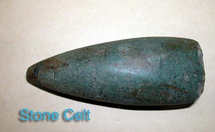
Mick and Susanna are conducting the annual Random Sample and Accession Inventory this week. Out of a total of 15,000 catalogued artifacts, we sample 202 and confirm that the object is found, that the location is correct and if all associated records are in order. As well, we confirm that all 254 Accessions are located. This inventory gives us a chance to go through all the storage cabinets and to see some artifacts that are rarely viewed. An example from the collection here includes the first prehistoric artifact in our collection, a stone celt, and the first historic artifact, a glass rum tester. A fine sampling of the islands history! We also will inventory the Natural History collection, including bugs, coral, plants and mammals. This should take us the entire week so that by the time Ken gets back from the UNESCO conference on Rock Art in Guadalupe, we will get back to digging at Cinnamon Bay. Polished green stone celt, composed of jadeite, surrounded principally by albite, triangular in shape, collected from Reef Bay area, below the petroglyphs, by David Bratsch, c. 1958.

Friday, April 21, 2006

Earth Day

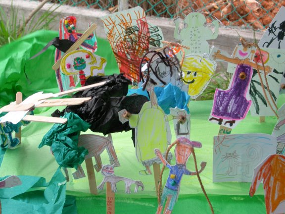
Crafts made out of recycled materials
Earth Day, 2006

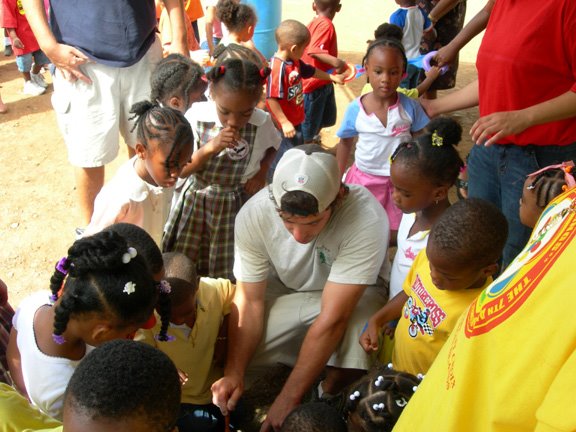
We just returned from a successful Friends of the Virgin Islands National Park Earth Day Celebration, 2006 on the ball field in Cruz Bay. There were many booths for the schoolchildren to visit: recycling, organic gardening, recycled crafts and of course, the National Park Service. Our Resource Management Team staffed a table which gave an overview of how we protect the natural resources of the island, such as turtles and coral by using moorings, which prevent boats from anchoring in fragile coral and seagrass. Mick and Susanna had a mini-excavation for the children, complete with Taino potsherds and historic artifacts buried in tuperware boxes filled with sand. Armed with trowels and shovels, hundreds of kids got to experience a dig and learned the difference between historic and prehistoric artifacts. Exclamations of “I found something, I found something” rang out and as one adult participant said, “They’re getting bit by the bug.”
The event was a pleasant break from a week spent on the Archeological Sites Management Information System (ASMIS) and cataloging. For ASMIS, we updated the database with GPS points and photographs. Mick continued to catalog VIIS-227 which is field finds and prepared three reports on the Turtle Bay Shovel Tests, Cinnamon Bay Erosion and the Caves. Ken has been preparing presentations for the upcoming Society of American Archeologists(SAA) Conference in San Juan, PR next week, in addition to the UNESCO Rock Art Conference in Guadelupe the following week. Mick will also attend the SAA conference while Susanna works on collection management.

Monday, April 17, 2006

With Help from the Community


The first part of the week Mick was investigating the petroglyphs on St. Kitts for a brief vacation. Ken and Susanna visited Caneel with Chuck Pishko. Chuck had located an 18th century candelabra at the kitchen area of the historic mangers house. Since the artifact was in the open where it could be collected as a keepsake, he concealed it and marked where he had discovered it. We collected the GPS data and the artifact. Thank you Chuck. (photo: Chuck Pishko with candelabra at Caneel)

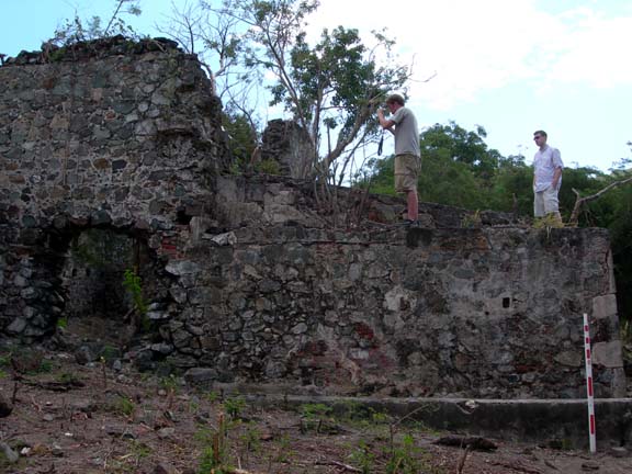
Much of this week was devoted to cataloging. However, the interns had a busy and exhausting day on Thursday. The government requires each park to document the existence of all archeological sites, most sites have to be visited, and their condition reassessed every five years. This year we must find seven sites that the park has never assessed. We visited three of the sites on Thursday:, Hope, Paquerau, and Bordeaux Plantations. Luckily, for us, we were able to enlist the help of Peter Burgess, a St. John resident and avid hiker who is familiar with the locations of all three plantations. Peter had been there several times and generously volunteered to take us to the plantations. Following an Old Danish road, he led us up and down Bordeaux Mountain to each plantation. At the plantations, we assessed the condition of each archeological site and buildings. We collected GPS points on the corners of each structure so we can put them accurately on our GIS map and enter them into our Archeological Sites Management Information System (ASMIS). We also took length and width measurements of the buildings. Susanna photographed the buildings with us working as further documentation in the event the park is audited. We accomplished a great deal thanks to Peter and his knowledge of the island.(photo: Peter and Mick at Hope Plantation; Threat of Vegetation to Ruins at Paqeurau)

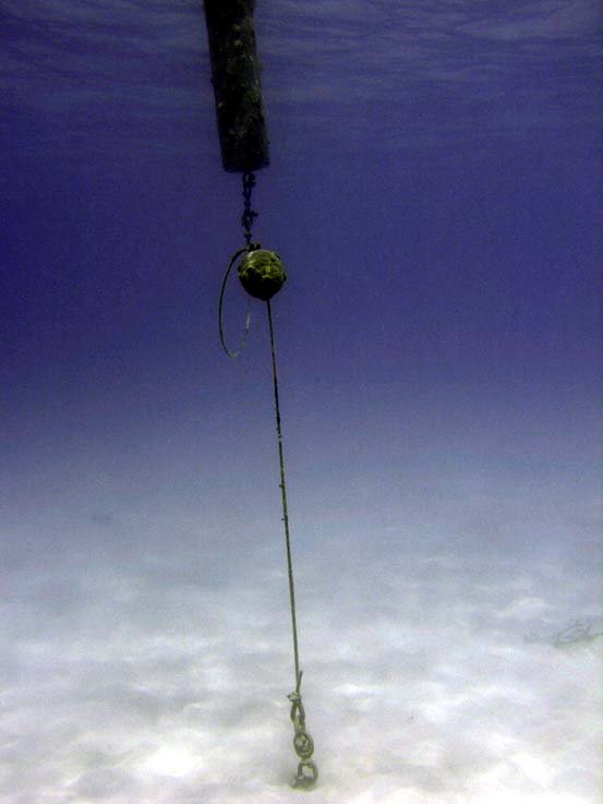
On Friday, Ken and Susanna completed an underwater survey at Trunk Bay so the park can install two sand screws for a dingy tether (a place to tie your dingy offshore). The tether will allow a dingy a place to park when the shore swells are too high for a safe beach landing. This archeological survey work is an example of basic resource compliance. In other words making sure that when they build, install, repair, renovate, restore, stabilize, or demolish anything in the park we first make sure no cultural resource are going to be damaged and if so, then a new process of mitigation is followed. But that is another story as nothing was found Friday except abandoned masks and snorkels.


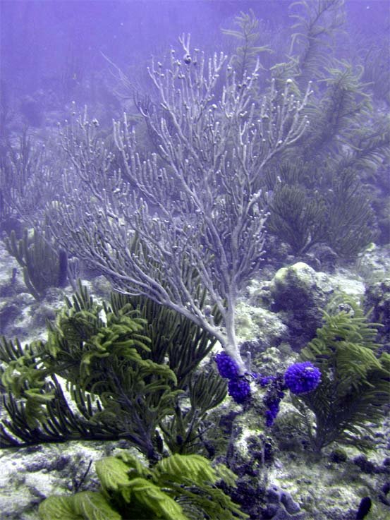
(Photo: Channel Marker Screw in Trunk Bay, Depth, 15ft; Coral in the vincinity of cultural resources, Trunk Bay, 25ft)

Friday, April 07, 2006

Returning Home


Under the supervision of Ken Wild and with the help of interns, the Cultural Resources of the Virgin Islands National Park are in good shape. However, it wasn’t always the case. One of the truly disturbing thoughts to those of us involved in archaeology in the park is thinking about all the artifacts that have walked off this island in the past 300 years and are in private collections. The story of the Virgin Islands early history is built upon archaeological evidence, and when artifacts are removed by untrained individuals, entire persons, plots and events go with them.
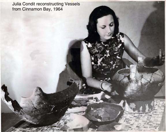
One important person in the story of St. John’s archaeological past is Mrs. Julia Condit. Mrs. Condit was the wife of Caneel’s Resident Architect, Mr. Thomas Condit. Together, they spent more than eight years on St. John and Julia spent an extraordinary amount of time piecing together the archaeology of the island. The Daily News from Friday, May 8, 1964 wrote that, “as an amateur archaeologist, Julia has worked with zeal and insight which have won ungrudging praise from the professional archaeologist.’ Thanks to her, valuable artifacts were saved from the dirt pile and oblivion during bulldozing operations at Caneel and Cinnamon Bay. Julia meticulously collected and restored hundreds of widely scattered pottery fragments which were put on display at the NPS Museum. Fortunately, the park has much of her collection intact today.
Ken Wild learned of Mrs. Condit about two years ago from Inga Hiilivirta from Islandia Real Estate on St. John. Inga knew the Condit’s in the 1960’s and gave Ken Julia’s number. Julia sent Ken some photographs and articles about her work. Ken learned that Julia had been asked by NPS employees to keep some of the artifacts because the park did not have the ability to curate the objects at that time. So Julia had been keeping them safe with her for fifty years!
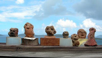
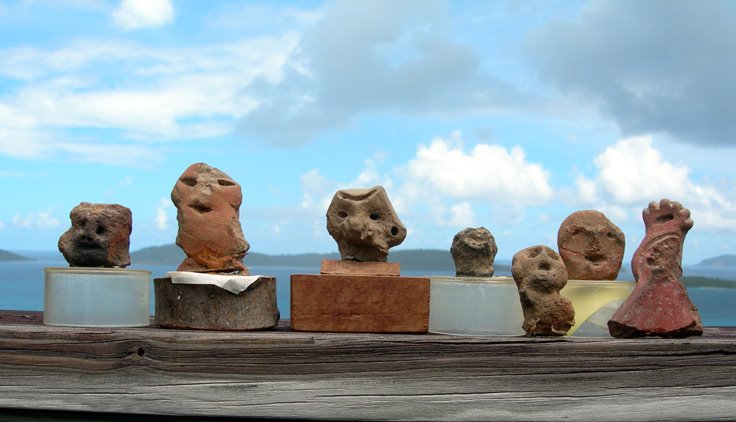
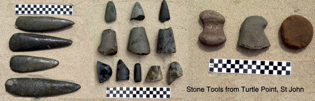
About two month ago, Susanna began working as a contract curator for the NPS and called Julia again. Julia agreed to send the artifacts back to the park and this week they arrived. What a wonderful collection! Inside the boxes were celts and stone tools, pottery sherds, shell ornaments and effigy faces which probably date between 1000-1450AD. When these artifacts are catalogued and placed in the collection, along with the information provided by Mrs. Condit, a new chapter in the story of prehistoric St. John will emerge.
Today, the Virgin Islands National Park is seeking the return of artifacts which have been removed from the Park. If you have any information regarding the removal of artifacts, please contact the park. Text and photos by Susanna Pershern
Monday, April 03, 2006

More Exploring


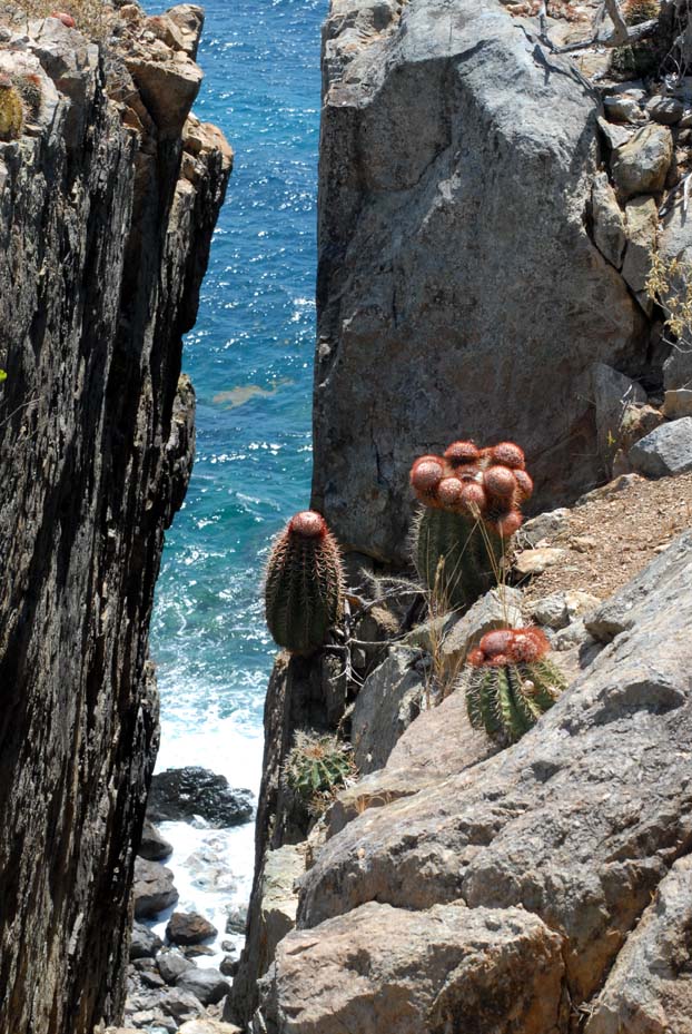
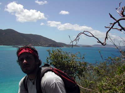
(On Cabrit Horn, St John)
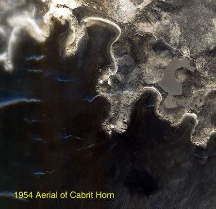
We have taken some time off from our current dig at Cinnamon Bay to pursue a few other projects. Last week we took a trip to Cabrit Horn to try to find two ruins to assess their condition for our site files that we keep in a government database termed ASMIS. ASMIS stands for Archeological Sites Management Information Systems. We found the Mandal Plantation. We searched for the ruins of a hospital for a while but to no avail. We’ll try again with a little more time examining the aerial photographs to see if we can pinpoint any square structures in the area that might be this historic hospital.


Andrew Connor and Mick Wigal spent several days putting the finishing touches on the Turtle Point dig. We completed all the cataloging of the artifacts and created a computer map of our shovel test units. Unlike our hand drawn maps, we are drawing this one in 3-D. Ken wants to brush up on his techniques with the software while teaching us the advantages of using this technology. Completing these steps allows us to finish the report for the project.

Intern Andrew Connor returned home to Massachusetts this week. He was a great help to Virgin Islands National Park archeology during the three months he was here. Hopefully he learned a great deal while working here and will pursue archeology as a career after finishing a degree in Anthropology from Augsberg College in Minnesota.

Friday, March 24, 2006

Reburial Project Excavation and More...


Update March 20-24, 2006
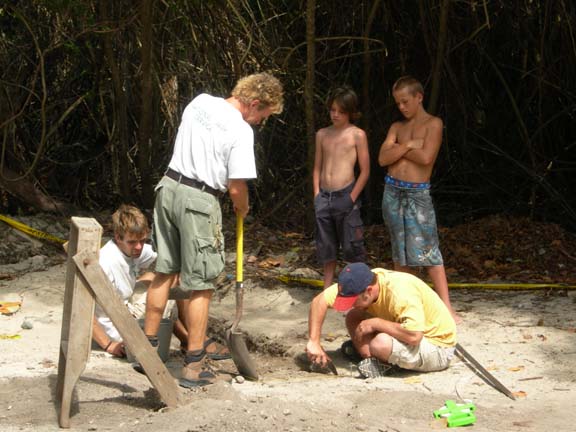
We began this week with a shovel test at Cinnamon Bay. We are excavating this small test to assess the area chosen with the island clergy for the reburial of the human remains that have been eroding from the beachfront here for 30 years. Directly behind the warehouse, at 22 centimeters below the surface (cmbs) we discovered a distinct historic mortar floor. This building was somewhat of a surprise, as the historic maps don’t depict a building here. We are going to have to look close at the estate inventories once the artifacts give us a time frame on construction. Right now annular whiteware sherds indicate it was occupied to the mid-1800s but a bottleneck found embedded in the mortar floor suggests the floor could have been constructed in the late 18th century. We have extended the shovel test horizontally to find the dimensions of the floor so we can avoid impacting this historic structure when we reinter the Cinnamon Bay human remains. On the very surface before we even started digging we recovered a historic pick and hoe, along with historic pottery, glass, metal and prehistoric sherds. We will continue this exploratory work until we find a suitable location to excavate a 2x2 meter grave, which we figure will be large enough for two ossuaries. Why two? One ossuary for the human remains that have been found up until now, the other ossuary is for those remains that will be found in the future from this eroded beachfront. We will be continuing this work next week, but we also have on the agenda trip to Hassel Island with the Friends of the Park supporters. We will try to bring back pictures of the diving bells.

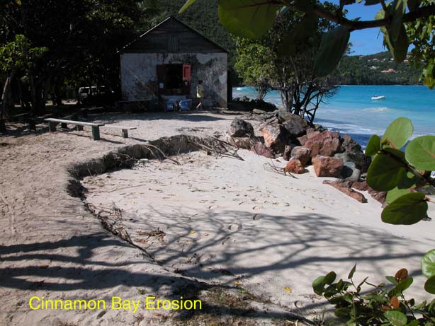
Ongoing is our monitoring and recovery of diagnostic or museum quality artifacts before they are lost to the erosion occurring at Cinnamon Bay. This week, a decorated fragment of Delftware was recovered which dates generally from 1600-1802. It is patterned with iridescent blue flowers. We intend to do further analysis to narrow the date range on this rare find.

This week UNESCO invited Ken as an expert on Petroglyphs to a meeting in Guadalupe of Rock Art experts in the Caribbean for the feasibility of a transnational nomination of rock art to the list of world heritage sites. You can find the petroglyph paper written for the public and further information about Cinnamon Bay at the Friends of the Virgin Islands website: www.friendsvinp.org.

Friday, March 17, 2006

Thank You!


The Maine students finished up their work this week at Leinster Bay and we spent today getting all the gear out of the field and back to the lab and office: ladders, machetes, a tent, freshwater, map table, tools and more. It was a beautiful day and as we traveled by boat to make the work easier, we got a chance to take pictures from the water and to see some sites. Thanks to all the Maine students for their super work on the 3-D modeling!

Friday, March 10, 2006

Virtual Preservation of Historic Ruins


Thanks to a grant from the Virgin Islands Humanities Council, the Friends, and the professors and students from the University of Maine, we are spending the next few weeks mapping plantation ruins into 3-Dimensional space on the computer. We archeology interns have spent our last week helping to get the Maine students situated and ready to work as they left the cold and snow and arrived down here in the fun and sun. We spent a few days getting their tents ready at Cinnamon and a field tent at Leinster Bay to protect the equipment. The students are now hard at virtual preservation.
The Maine students are using an additional program that is proving to make modeling much easier and more efficient to use with the other programs. The new program allows them to photograph the ruins from a variety of angles and, using dots they have placed around the ruins, “sew” these photographs together. We are already seeing exciting results after only three days of work. The students already have one wall complete and are working on modeling a well and another wall. We presented the work to members of the press and supporters this morning at the ruins and have another presentation on Monday.

Thursday, February 23, 2006

Cave Expedition II


Exciting weeks-- We find the Prehistoric Caves, Evidence from the 1733 Slave Revolt, and an Underwater Cannon that may Predate the Danes dating to the 1600s. Graphing C-14 dates give New Insights into the Pre-Columbian Peoples at Trunk Bay.

This week we are analyzing and cataloging the artifacts we unearthed in our Caneel Bay shovel tests. It is painstaking work but is necessary to complete our research and ensure that the artifacts are easily accessible to future archeologists who might continue after our efforts. Our first step in this process is cleaning the artifacts, which was done with the help of two volunteers. We then analyze the artifacts from each unit and level separately. We weigh and count everything we find. In some cases, we might discard some objects, such as shells that are not related to the archeological record and therefore not diagnostic. We still have to ID them, record their weight, and count each species. Everything we keep we sort by the thousands of diagnostic attributes they may fall into, and then assign each sorted object(s) a catalog number. Lots of prehistoric pottery was recovered and interesting stone tools (one of which is pictured in a previous blog entry). There are also several stone grinders and numerous stone flakes that indicate tool creation. During our analysis, we discovered one artifact that was particularly unique and which we incorrectly thought was a stone flake at the dig site. Upon closer examination, Ken determined it was actually a French gunflint probably for an eighteenth century musket. It is possible that this artifact along with the early colonial pottery is evidence of the French troops who were brought to St. John to quell the slave revolt of 1733.

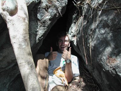
Connor and I also had to return this week to examine the caves we found for evidence of prehistoric occupation and to explore for more caves. This time we remembered to bring a headlight. This helped a great deal, as we were able to actually see inside the caves. In the first cave, Connor found one small potsherd on the surface. It was exciting to discover that these caves were used by Tainos or perhaps their ancestors. At the next rock overhang, we found several more potsherds and charcoal. We also found two more small caves, one of which had a Cittarium pica shell, locally known as whelk, which was a prehistoric food source, but could have also been the former home of a Soldier Crab. I hope that future investigations will reveal good diagnostic artifacts and give us deeper knowledge into the extent of occupation and the caves' use.


A couple of weeks ago Ken and Susanna followed up on a lead that park biologist Thomas Kelley discovered while diving in the park. Thomas reported spotting what looked like a small cannon. Upon inspection it appears that, indeed, it is a cannon but of the most unusual design. It may be possible that the cannon is from the 17th century as the design and pottery in the area appear to go back to a pre-Danish era. More information will be forthcoming about the cannon as investigations continue.

Over these last two weeks, we have also had the pleasure to host Dr. Emily Lundberg and her husband Bert and his daughter Deborah. Dr. Lundberg came from Montana to work with Ken on the Trunk Bay ceramics. We interns just recently completed entering some several thousand ceramic data records into an Access program so they could start asking the data some questions. While we were out in the field, Bert and Deborah addressed the lab’s visitors allowing Emily and Ken a chance to focus on the work. Their goal is to define the ceramic chronology of the Virgin Islands from AD 800 to 1200. The dates for the site became much clearer this week after Ken graphed out the fifteen C-14 dates. He found that excavations conducted for the ramp that begins at the fee booth, the septic tank next to the concession area, and the present men’s bathroom all clustered within a 200-year period beginning in AD 1000 and ending around AD 1200. Two other sectors of the site were found to date to AD 800-1000.

Friday, February 17, 2006

Sierra Club, Elderhostel and Historical Society


Monday February 6-Wednesday February 15
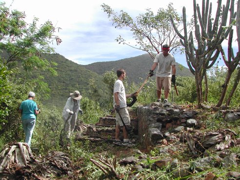
Clearing vegetation from historic ruins has kept us busy these last couple of weeks but we have had plenty of volunteer help from the Sierra Club and the Elderhostel. These groups have generously provided their vacation time in St. John to help us keep Colonial era ruins free of destructive vegetation. This work helps to preserve the ruins and makes them visible for the public but is especially important this week because of two upcoming projects.

The first sets of ruins were Yawzi Point and Little Lameshur Bay. The park has received funds to restore some of these ruins. Therefore, a first priority is to clear the vegetation to allow the historic preservationists access to the ruins to assess them and begin work. The Sierra Club made it possible to clear all these historic structures in three days. Next, we cleared the ruins at Leinster Bay. In this undertaking, we enlisted the help of an Elderhostel group and a new group of Sierra Club volunteers. It was important that this work be done now to prepare for a group of engineering students and their teachers from the University of Maine.

As part of a Virgin Islands Humanity grant, U. of Maine is coming back in March to continue the park’s efforts to model endangered ruins in 3D. We had to clear enough brush away from the structures to allow them to be photographed from a distance, as well as to be accurately measured. Since there are at least 500 ruins on St. John, it is impossible to restore or preserve all of them now. The hope is that they can be preserved on computers in 3-dimensional space. Not only will this allow interested parties to tour the ruins in cyberspace, but it will also create an exact blueprint of the structures so that they could, hypothetically, be rebuilt in the future. It is, for now, our one financially viable way to preserve this past for our children before they become piles of unidentifiable rubble.

We also assisted the St. John Historical Society and Elderhostel in clearing the Annaberg School ruins. The goal here was to make the ruins a more picturesque and enjoyable place to visit. We were more than happy to help on their effort to help the park.

We owe a big thank you to the Sierra Club and Elderhostel for all of their hard work. Without them we would spend many more days getting these ruins cleared of the destructive vegetation. We appreciate them taking time out of their vacation to help us.

Cinnamon Bay: Proposed Museum Exhibits in 3-D

BY Ian Kaminiski-Coughlin

My internship has a different objective from those of the other interns. Ken Wild contacted one of my professors at the University of Minnesota in search of someone with knowledge of historic architecture to design museum exhibits and new laboratory fixtures for the Cinnamon Bay Archaeology Lab. Michael Milne, known to St. John as the barefoot architect, has taken me into his office of five (one of the largest firms on St. John) and donated my wages to the Friends of the Park to accomplish this. I work on this project half the time and help with Michael’s busy residential practice the other half.
The building in which the museum and new lab will be located in one of the oldest structures still in use (1680’s) on island and, as such, is a fitting locale. Presently there is no venue to display to the public the park’s diverse collection of prehistoric, maritime, and colonial artifacts. I feel fortunate to be one of the first contributors to this project that will display this island’s heritage to the local community and their visitors.

Wednesday, February 08, 2006

Shovel Tests in Paradise


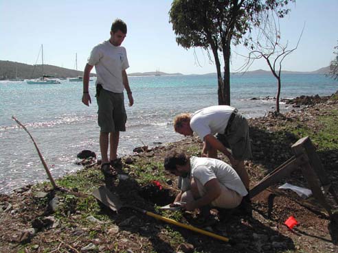
For the past two weeks Mick Wigal and myself (Andrew Connor) have been conducting shovel tests at Turtle Point in Caneel Bay. Our hope is that this example of mitigative archeology will help us gain a better understanding of the layout of the pre-Taino village and any historical structures that existed in the area, while exploring for areas of the site that have been disturbed. We know a prehistoric site exists in the area due to the abundance of potsherds on the surface and artifacts that have been found there in the past.

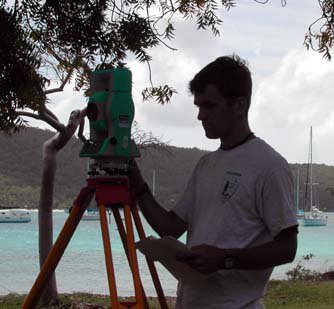
Our first few days at the site were spent working with the laser transit. The transit allows us to create a survey map of the shoreline, trees, parking lot, shovel test units, and any other features on the site. Once we've "shot" these features into the transit we can transfer the data to a program on the computer that will allow us to create a map of the site.

After grappling with the transit for several days we created a grid on the site that would allow us to easily locate our shovel test units. Ken chose to dig four .5 X .5 meter units. These units were spread across the grid. They allowed us to determine the extent of damage due to machinery, examine artifacts in an area threatened by erosion, and explore a squared mound of soil.

It took us two weeks to complete all four shovel tests but we found some interesting artifacts. All four holes contained numerous prehistoric potsherds and ecofacts consisting of cittarium pica shells (a large snail), conch shells, parrotfish vertebrae and beaks, and other small snail shells. These are examples of food remains and the conch could also be used as a tool.

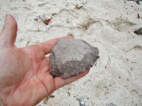
One unit was filled with stone flakes that are created by scraping pieces off a stone core. This suggests that there may have been a prehistoric stone tool factory in this area. We only found one example of historic pottery. Our most exciting find came on January 1. While excavating I came across a stone axe or scraper that had obviously been chipped down to a very sharp edge.

Thursday, February 02, 2006

A Farewell to James


Intern James Trombetti left today to return home to Kentucky. Although James was a biology major, he took a great interest in archeology. He was a hard worker and excellent asset to the team. As an intern James worked on Cinnamon Bay shoreline, Trunk Bay, and Turtle Point excavations, while also assisting in mapping, historic structure preservation, and interpretation. He will be missed by everyone. James is planning on attending Ranger School in the fall to become a law enforcement Park Ranger. Good luck James!

Wednesday, February 01, 2006

In Search of Prehistoric Caves

January 16, 2006-January 20, 2006

This was an eventful and exciting week for the archeology interns. The new intern, Andrew Connor, arrived on Monday from Massachusetts. I'm sure the weather change was more than welcome. His first day was spent getting familiarized with the Cinnamon Bay lab and getting to know everyone.

James Trombetti and I gave our first St. John archeology talk to tourists at the lab. Andrew listened to get a taste of some of the island's Taino and plantation history. The talk was a success, with eighteen people attending. Everyone gave us good reviews and several people came back later to thank us.

The most exciting event of the week, though, came on Wednesday. Ever since I started working, I have heard of a purported prehistoric cave on the North Shore. Apparently two archeologists surveyed St. John in the 1950s and briefly wrote about the cave in their subsequent report. Rumors about the cave abound around the island. Lots of people have heard of it and seemingly everyone knows someone who knows where it is. Frustratingly, no one has told us where it is.

James and I have already hiked up the point twice looking for it but to no avail. We actually have a method for looking for it. Using the GIS program on the computer, we look at an aerial photograph of St. John and find points on Mary's Point that look like they would have terrain suited for a cave. We then enter these points into the GPS. The GPS aims us in the direction of the points and shows us where we've been so we don't survey the same area multiple times.

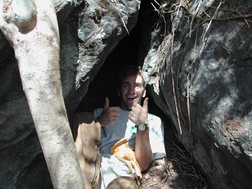
For our third trip, we headed for a huge rock that sticks out above the trees. The jungle was thick with thorns but we eventually made it to the rock. The entire area was covered with huge boulders. The first one we examined had a narrow hole that was just big enough for a person to crawl through. The hole opened into a small room that was big enough for maybe two people to stand in. I crawled in but didn't see any artifacts or petroglyphs. There was a layer of soil in the bottom of the cave so we may have to excavate in search of a human presence. We found several other rocky overhangs that could possibly be considered caves. We only explored about half of the boulders, so more exploration will be necessary to determine if other caves exist.